AquaPulse
Water intelligence for India
See where water risk is rising.Understand what happens next.Act before impact.
0districts need attention at the last update
0 flood and river alerts · 0 states and UTs
Data delayed. Official alerts from NDMA SACHET and IMD, last synced 06 Nov, 22:15 IST. The same figures the live map shows.
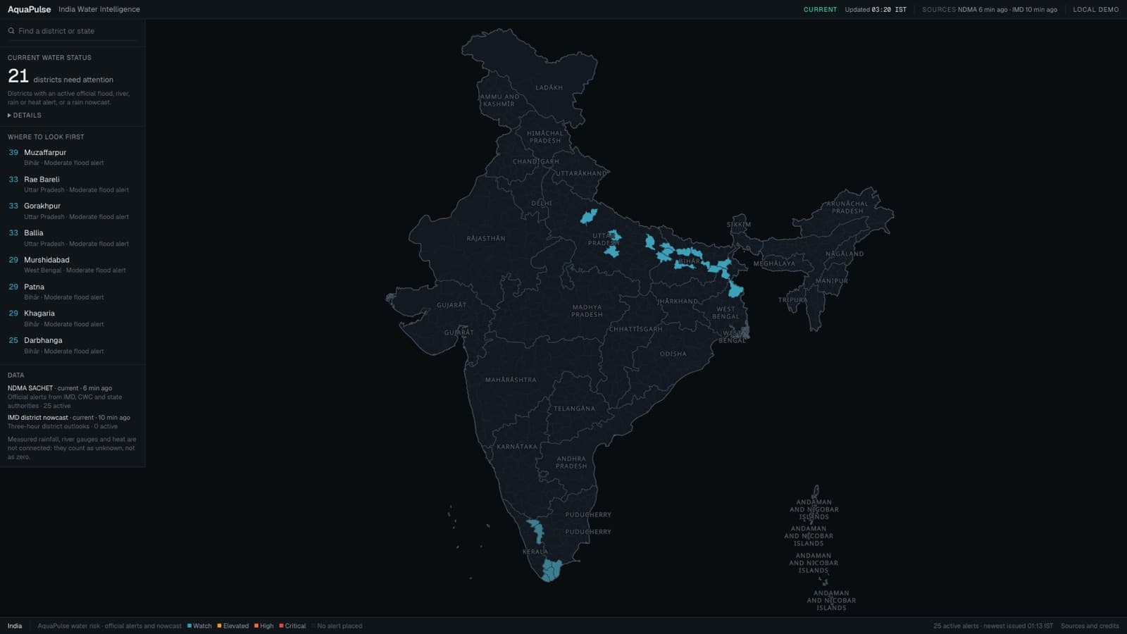
The live map. Highlighted districts hold an active official flood, river or rain alert.
Most systems tell you what happened. AquaPulse shows where the problem is, why, what happens next, and what to do about it.
- 01ObserveOfficial alerts across India
- 02VerifyReports from people on the ground
- 03PredictA local forecast, 60 minutes ahead
- 04ActThe response that protects most
- 05LearnWhat to repair for good
01 · Observe
Official signals, mapped by district.
AquaPulse reads India’s national alert feed and IMD nowcasts. Every district shows its risk, the alert behind it and when it was issued.
Inputs that are not connected are shown as unknown, never as zero.
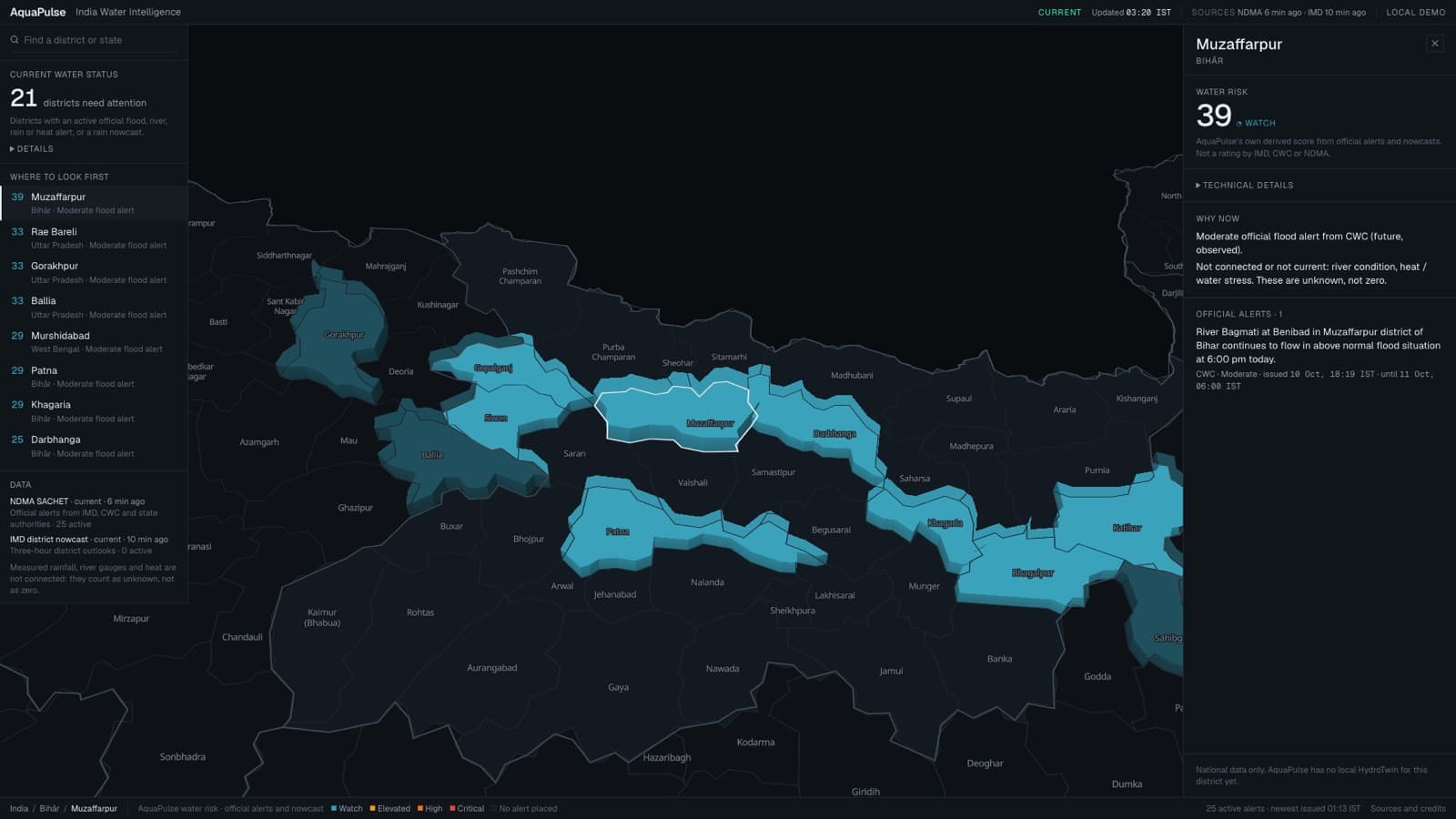
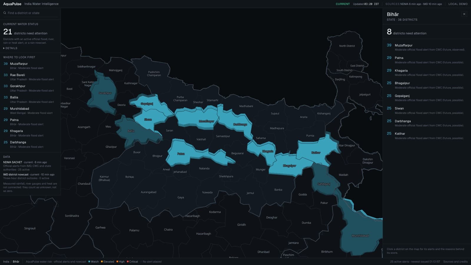
National to local
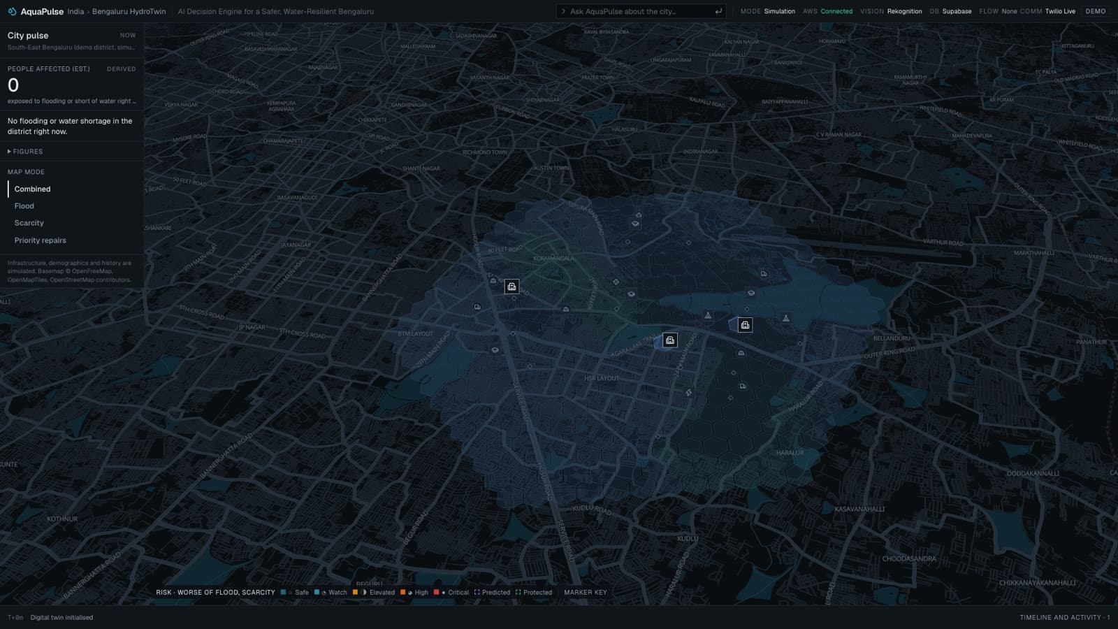
One map, from the country down to a street-level forecast.
02 · Verify
Reports are evidence, not pins.
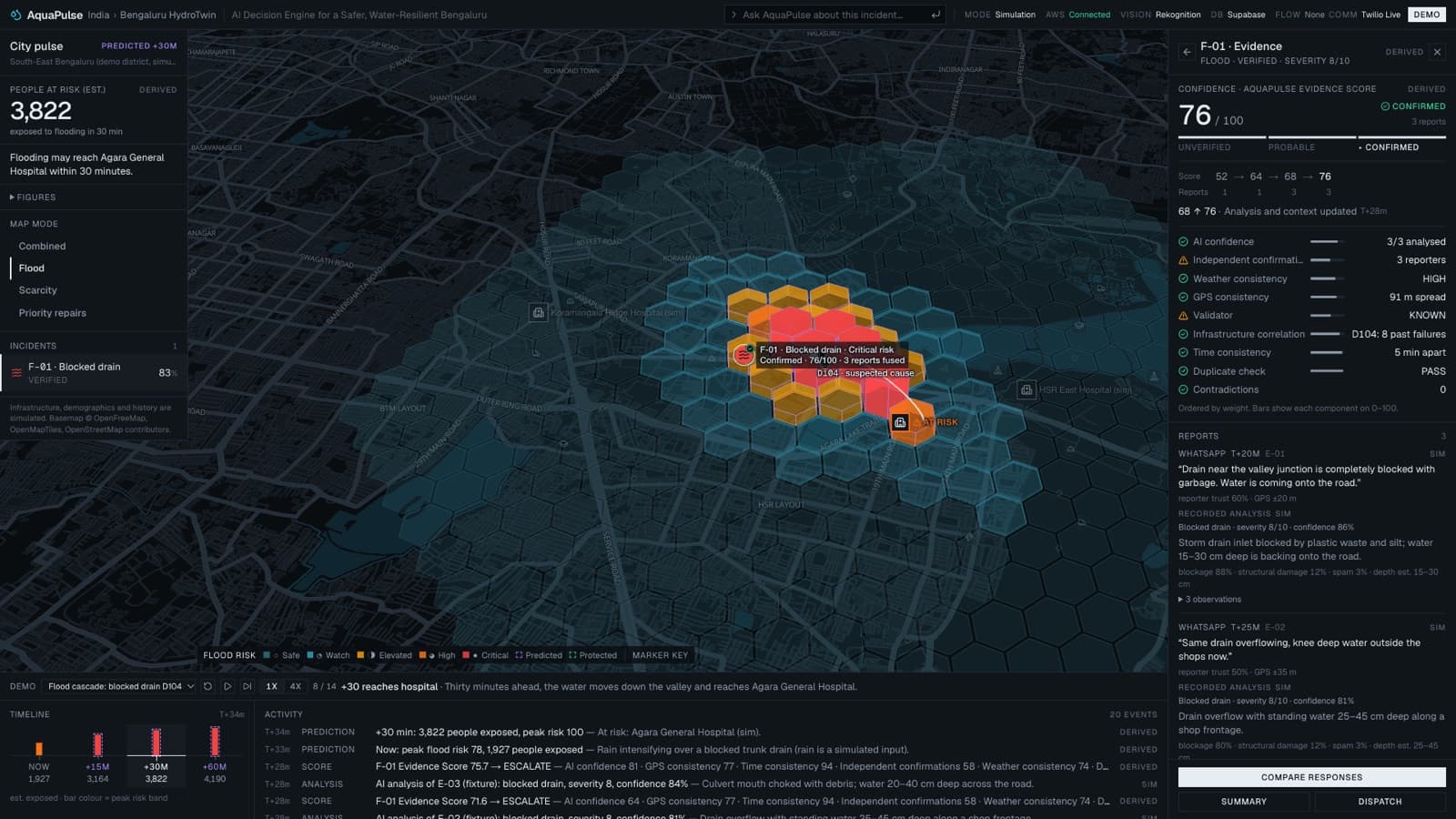
A report arrives, a photo is checked by Amazon Rekognition, and nearby reports are combined into one incident with a confidence you can inspect.
One unsupported message stays unverified. In our test it scores 14 out of 100 and nothing escalates.
03 · Predict
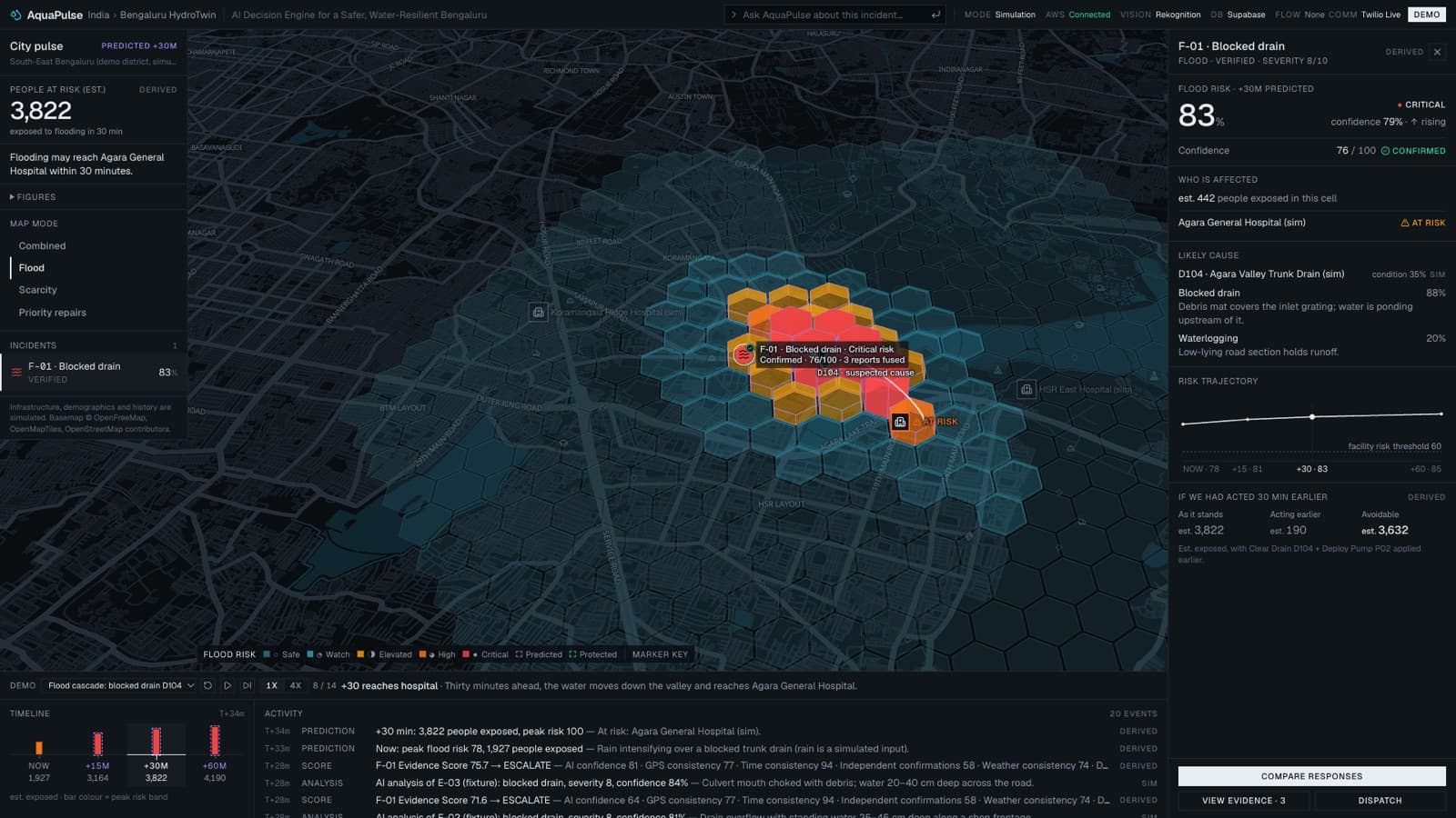
In thirty minutes the water reaches the hospital.
Where a local model exists, AquaPulse forecasts cell by cell for the next hour. The first covers south-east Bengaluru; its city data is a labelled simulation, so the scenario is repeatable.
04 · Act
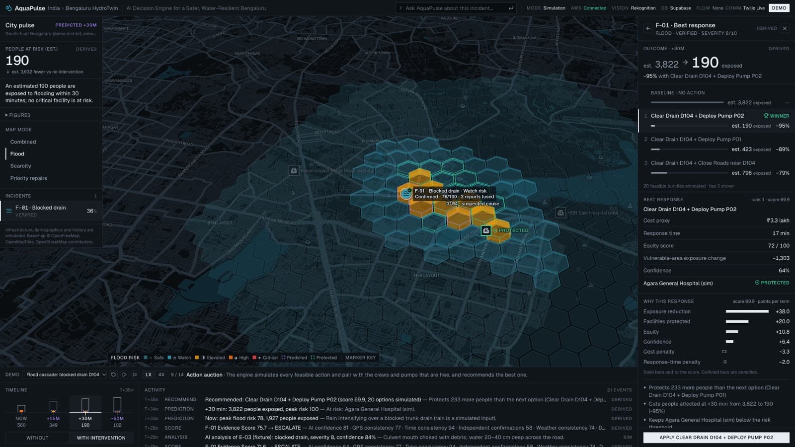
3,822190
estimated people exposed, before and after the best response
Hospital at riskProtected
Twenty feasible actions are simulated and ranked. Clearing one drain and deploying one pump wins, and the ranking shows why: people protected, facilities, equity, cost and response time.
05 · Learn
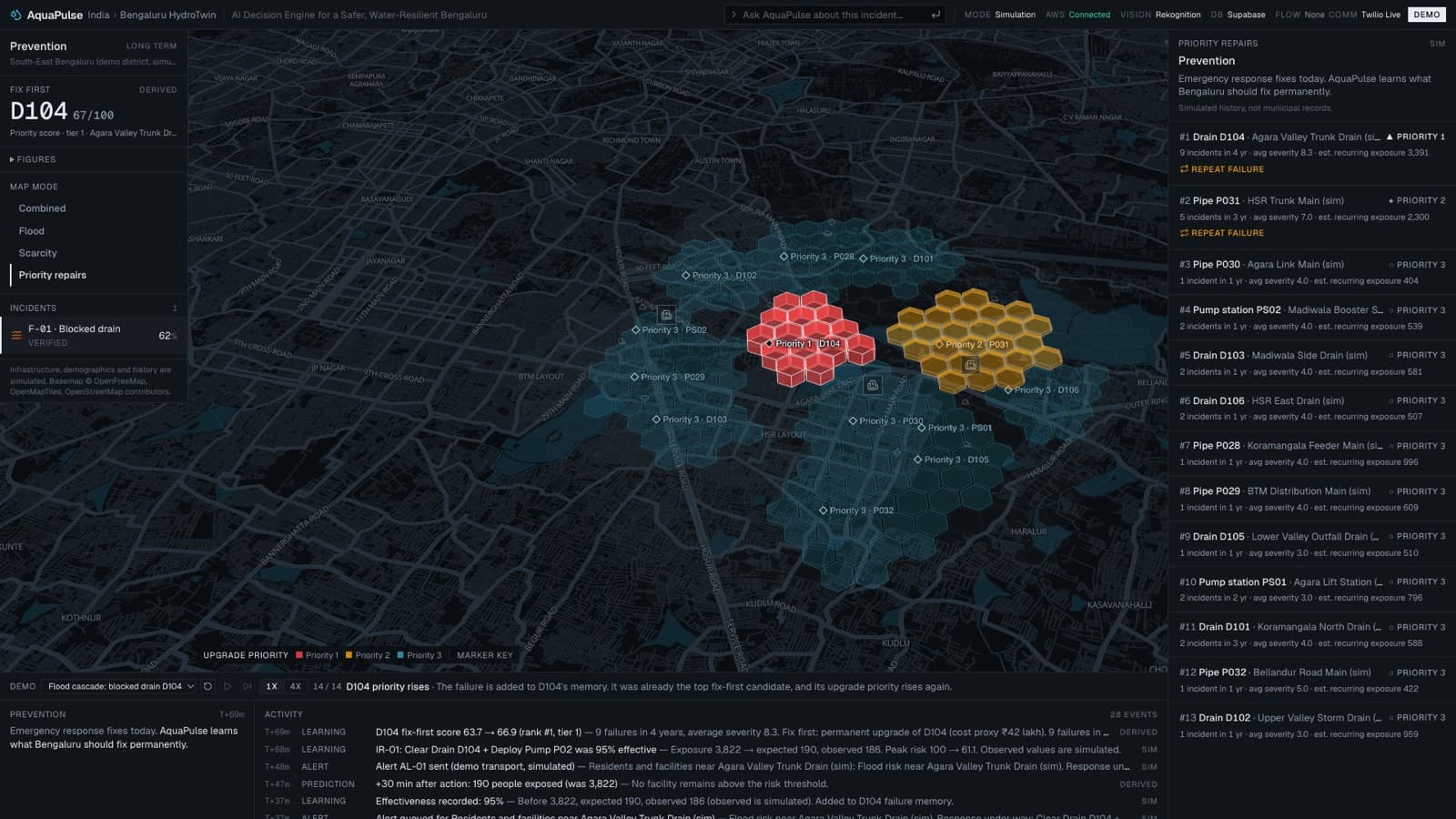
What should the city repair for good?
Each response is checked against its forecast, and each failure is remembered. The result is a ranked list of permanent repairs, not just today’s fix.
The same engine handles shortage: when a trunk main fails in a heat spell, tankers are allocated by need, hospital first.
What is real
Everything is labelled.
Official data and citizen reports come in. AWS checks the evidence. PostGIS stores it. The engine forecasts and ranks responses.
Live
- Official alerts: NDMA SACHET, IMD nowcasts
- Photo checks: AWS Lambda and Amazon Rekognition, logged in CloudWatch
- Storage: Supabase Postgres with PostGIS
- Incoming reports appear on the map within seconds
Simulated, and labelled
- Bengaluru infrastructure, populations and failure history
- The flood, shortage and false-report scenarios
- Observed results of a response
Not connected yet
- Measured rainfall, river gauges and heat
- WhatsApp from a real phone, and n8n
- Amazon Bedrock: answers are built from engine output, not a language model
National observation. Local forecast. A response you can check.